In-class Exercise 7a: Geospatial Analysis using Tableau
1 Overview
In this exercise, we have some more hands-on using geographical data on Tableau.
We use the realis 2022-2023 data to analyse the property data.
2 Load data
We have 8 realis files and we union them in Tableau.
3 Proportional Map
Note
Note that there are 429 unknown postal codes as they are not available in OpenStreetMap.
We also created a tooltip sheet to show the median unit price for each quarter.
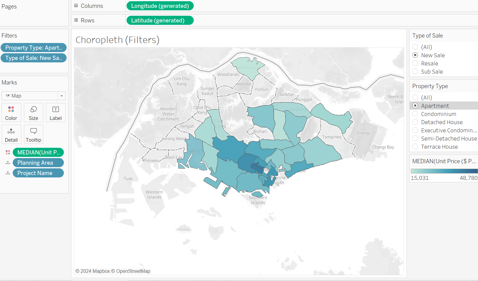
4 Choropleth
We use the Planning Area in the map, hence we need to change it to a geographic role using State.
5 Treemap